
Terengganu is always thought of as a State with sandy beaches.
In fact it is a mountainous land with only a narrow strip of beach. Most areas inland are sparsely populated. Many waterfalls are yet to be identified.
Traditional waterfalls and their parks are now being spruced up and very well maintained. They are worth visiting.
In fact it is a mountainous land with only a narrow strip of beach. Most areas inland are sparsely populated. Many waterfalls are yet to be identified.
Traditional waterfalls and their parks are now being spruced up and very well maintained. They are worth visiting.
Lata Tembakah
| State | Terengganu |
| Location | 25 km south of Jertih |
| Coordinates and map | N05° 35.17' E102° 26.83' |
| Water Source | Stream |
| Waterfall Profile | Vertical Falls & Cascades |
| Accessibility | Nature park |
The Tembakah Waterfalls are probably the most impressive falls of Terengganu. The Hutan Lipur Lata Tembakah is clearly signposted and can be reached from Jertih. Coming from K. Terengganu a shortcut is possible by taking the T142 near Kg Jabi.
 This is the sign you will see, when you come from K. Terengganu
 The park is well maintained with many facilities
The first waterfalls are actually more like cascades. They have nice, large pools, which make them perfect for family outings. Not surprisingly, this park can be crowded!
 The first cascade
 Some of the cascades can be used as (bumpy) slides.
When you follow the trail along the river, you reach the main fall of the park. It is number 4 of the list.
 The nr 4 waterfall is very impressive
 It is a tall fall with an estimated altitude of 80 meters
 From this fall you can continue to the upper falls.
To reach the upper falls, there are two possibities. First, you can choose the jungle trail, which is clearly signposted. The other way is to scramble upwards at the right side of the main fall. Interesting but not easy.
 View of the mail fall, seen when scrambling uphill
 At the top of the main fall. Deep down the crowd of visitors is visible.
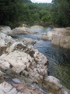
 After the main fall there are some quiet stretches
 View of the mail fall, seen when scrambling uphill
 At the top of the main fall. Deep down the crowd of visitors is visible.
 After the main fall there are some quiet stretches
The upper falls are also very impressive and as it takes some effort to reach them, they will be quiet even when there is a crowd.
 A slightly smaller brother of the main fall
 Also here a beautiful pool
 One of the quiet stretches
 quiet....
 and wild....
 The last waterfall
 A slightly smaller brother of the main fall
 Also here a beautiful pool
 One of the quiet stretches
 quiet....
 and wild....
 The last waterfall
0 comments:
Post a Comment